| 
Geocaching
: A New ATV & UTV / SxS Riding Experience
::Continued::
Jeffords said that the experience of geocaching
gets people to ride in parts of the forest where
they would not normally ride. “We have a
unique opportunity because we are surrounded by
five different National Forests. So we can hide
cans on the borders of the different forests within
riding distance so people get to see different
parts of the forests.”
| |
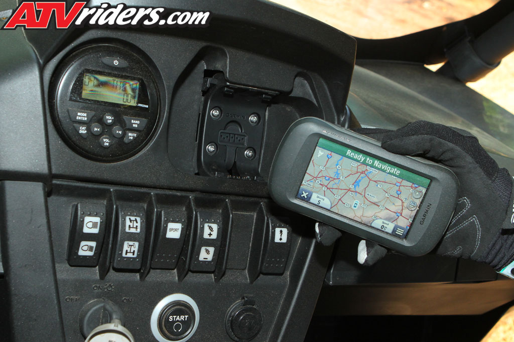
A GPS Receiver
like this one found in the 2012 Can-Am
Commander 1000 LTD Side-by-Side is necessary
for Geocaching
|
Of course, a major tool in the game is a GPS
receiver. Most people who ride ATVs and use them
to go hunting probably have used these receivers
and are familiar with them. However, for those
people who do not know how to use a GPS receiver
and want to participate in a geocaching event
have plenty of opportunities to learn how to use
them. “For example, we have a gentleman
in our club who gives lessons and we have speakers
who come to our meetings and show how to use them.
If you are out on a geocaching, then you can ask
for help from others there who are familiar with
the receivers,” said Jeffords.
Finally, The Ravalli County Off-Road User Association
encourages visitors from out of state to come
and enjoy their geocaching events. “We want
people from out of state to participate,”
said Jeffords. “We will give them coordinates
and if they win, we will mail them their prize.”
TheTrailsPath.com
is a site similar to geocaching.com.
It posts geocaching information including coordinates
and clues. It also posts information on trails
and provides maps. “If someone posts a ride,
we post that a geocache is on it or if people
post a ride we let them know that a geocache can
be put on it,” said David Wortman of The
Trails Path. “Sometimes we do treasure hunts.
They’re geocaching that include two or three
caches. Each cache provides a hint to the next
cache and so on. The last cache has a treasure
in it for the first to find it. The treasure can
be a gift certificate from a local sponsor,”
said Wortman. The Trails Path uses Google Maps
and puts a marker on the map where a geocache
is hidden.
| |
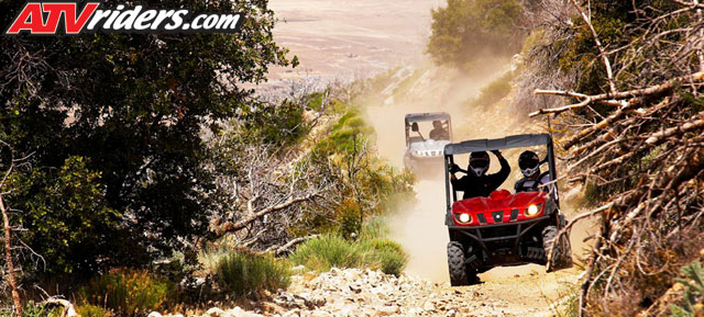
Go out &
explore new trails by Geocaching aboard
an ATV or UTV!
|
Since the site reaches out to ATV’ers looking
for information about trails they can ride, many
people who go to the site don’t know about
geocaching. “People from out of state go
to the site and find out about tracks they can
ride that has a geocache on it. I get calls and
e-mails from people who are coming out to Colorado.
They ask me what geocaching is. So the site helps
to create interest and lets people know that their
ride can include an added adventure,” said
Wortman.
“We’ve been doing geocaching for
two years. I am continuously learning what to
do. So we are still refining what we do,”
concluded Wortman.
|